About Me
My name is Matthias Markus Hinz. I am a research associate and PhD student from Germany with a Master's degree in Geoinformatics from the University of Münster. I am currently working at the Federal Maritime and Hydrographic Agency of Germany (BSH) and the Leibniz Institute for Baltic Sea Research Warnemünde (IOW) on the project OTC-Stone, where I am working on automated AI-based boulder detection in sonar data.
After graduation, I came to the University of Rostock where I worked for the e-learning project OpenGeoEdu and the regional planning project PROSPER-RO.
I am passionate about Geographic Information Science and Technology because it has a positive impact on the environment and society. I believe that it can help people in many different ways. My works include data science, remote sensing, spatial statistics, and software development for desktop and web-based applications. My most recent job also gave me experience in handling sonar and hydrographic data.
Please, do not hesitate to contact me, if you take an interest in my activities or if you want to introduce me to your project.
Professional Skills
IT Skills
| Programming languages: Java and R, basic knowledge in C++ and C# |
| Web Technologies: HTML, CSS, JavaScript, XML, Linked Data |
| Databases: Relational Databases (PostgreSQL, MySQL, PostGIS) |
| Operating Systems: Linux (Ubuntu) and Windows |
| GIS applications: ArcGIS, ArcGIS for Server, QGIS, OGC Web Services, Geodatabases (e.g. PostGIS) |
Languages
| German: Native language |
| English: Proficient user Medium of instruction in my past Master's studies |
| Spanish: Independent user
Certified UNIcert® II level, equals B2 of the CEFR (view certificate) |
| Basic knowledge in French and Korean (which I would like to extend in future) |
Works and Projects
This section presents some of my former works that I can share. Until now, it only contains content from before I started working full-time, but I plan to push updates when I can. I hope readers find them interesting, inspiring, and useful. The articles include downloads, live demos, and external links to further reading. Please leave me your comments.
containerit
Reproducible research with Docker and R, December 2016 to March 2017
“Put your app into a container, and it runs from everywhere!” — Docker allows packaging data and software into isolated containers that can be ported and shared. While you might spend many hours trying to install a program on your computer until it runs as it should, the container will run immediately. An appealing prospect, especially to data scientists!
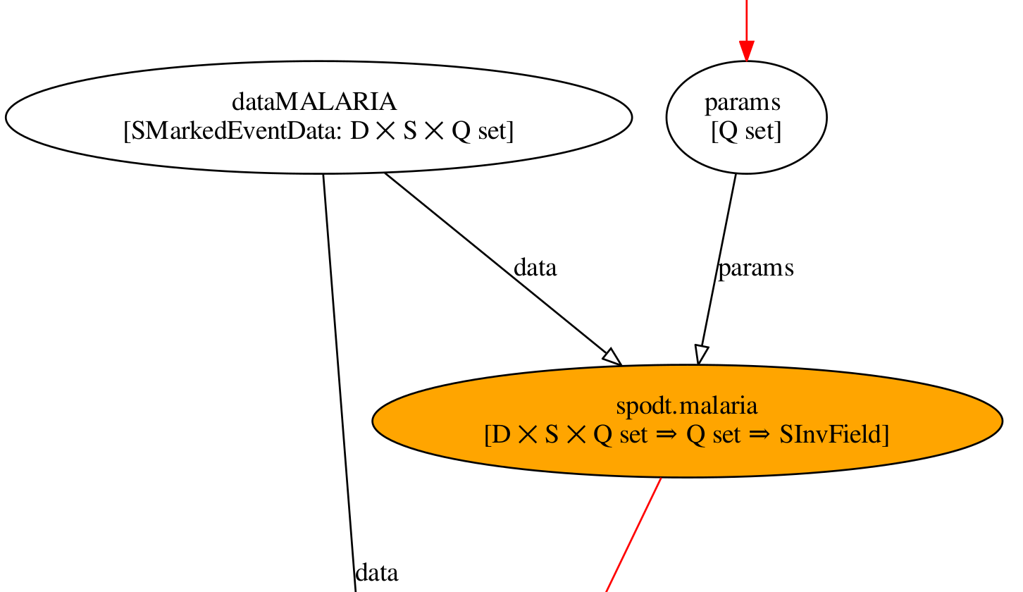
Communicating meaning and purpose of spatio-temporal data analysis
Master's Thesis, September 2016
In which part of a Malian city do the children suffer more often from malaria? How did the population of an immigrated bird species increase over recent decades? Spatio-temporal statistics can give answers to these questions. On the other hand, even for experts, it can be difficult to interpret the data and to understand how and why they were generated. In my Master’s thesis, I followed a semantic approach toward this problem. You can download the text from here.
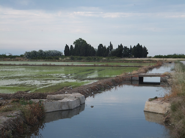
Rice Mapping in Europe
External studies in Spain, October 2014 to July 2015
During my Master’s program, I spent ten months at the University Jaume I in Castellón, Spain. It was an exciting time, as I could join the European research projects GI-N2K and ERMES. ERMES built up a rice information service that assists the European farmers and rice industry; GI-N2K provides guidance to the European education system of geospatial professionals.